|
4x4Outdoors.net |
Maps - Topo & Satellite |
|
|
|
Maps are indispensable to the outdoorsman. |
|
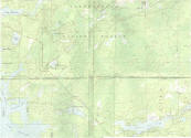
 7.5-minute maps Part of the 7.5-minute series map "New Orleans West Quadrangle, Louisiana," 1992, 1:24,000, Universal Transverse Mercator projection, 22 x 27 inches. The best known USGS maps are those of the 7.5-minute, 1:24,000-scale quadrangle series. A scale of 1:25,000 is used for maps based on metric units (1 centimeter = 0.25 kilometer). The area portrayed on each sheet ranges from 64 square miles at latitude 30 degrees north to 49 square miles at latitude 49 degrees north. A scale of 1:24,000 allows considerable detail to be shown in the quadrangle areas. It takes about 57,000 maps to cover the conterminous 48 States, Hawaii, and territories. All of these maps are now for sale to the public. (For Alaska, 7.5-minute maps at 1:24,000 and 1:25,000 scale are available for areas around Anchorage, Fairbanks, and Prudhoe Bay.) The sheet size is about 22 x 27 inches north of latitude 31 degrees and 23 x 27 inches south of that latitude. For Puerto Rico, the scale of 1:20,000 (1 centimeter = 0.2 kilometer) was adopted in the 1950's because it was a metric scale and the island had used metric measurements previously. The island was originally mapped at 1:30,000 scale, but this was changed to 1:20,000 to provide greater detail. The sheet size is about 29 x 32 1/2 inches. The U.S. Virgin Islands of St Croix, St. John, and St. Thomas have been mapped at a scale of 1:24,000; central Pacific islands at scales ranging from 1:10,000 to 1:50,000. |
|||||
